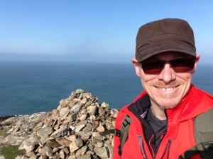
Date: Sunday, December 27, 2015. Weather: Wind, rain, fog.
Elevation: 990 ft. 3h 33m moving time. 4h 52m elapsed time. Av. pace 23 mins/mi.
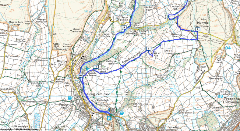
Mynydd y Betws is a mountain located on the border between Swansea and Carmarthenshire, south Wales. It is the highest mountain in Swansea, and the highest land between the River Loughor and the Upper Clydach River.
Date: Friday 1 January 2016. Weather: High winds, light rain.
Elevation. Total climb 527ft. Elapsed time 3:04 h:m. Moving time 2:42 h:m. Average pace 21:42/mi.Context. Encircled numbers, e.g. ②, refer to mile-interval markers, per maps / elevation.
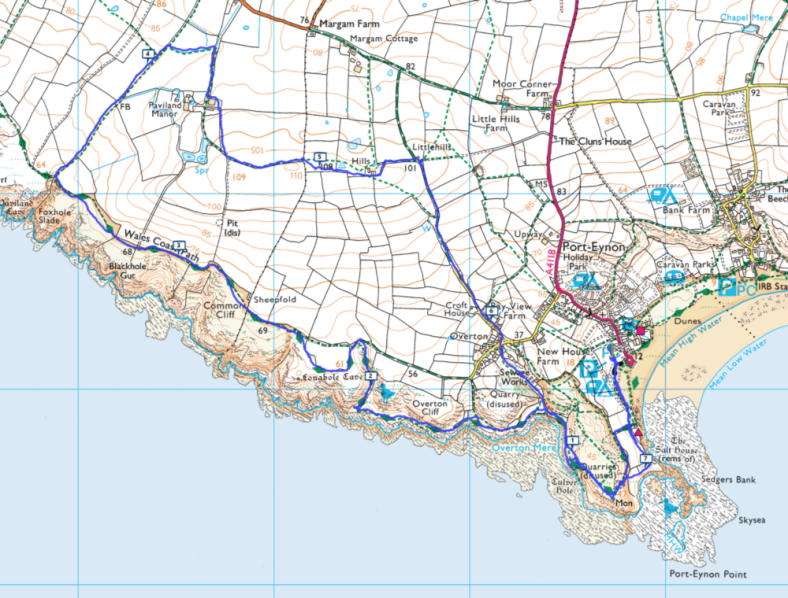
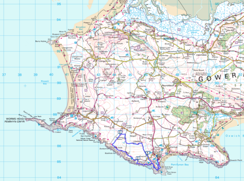
Port Eynon is thought to be named after Prince Einion of Deheubarth or an 11th-century Welsh Prince named Eynon. Eynon is a Welsh surname, evident in the village graveyard. Smuggling is thought to have been a common engagement of the local residents in the 17th century to 19th century. In the second half of the 18th century, through to 1919, a lifeboat was operated from Port Eynon. On several occasions, the lives of lifeboatmen were lost at sea on rescues. A memorial to these men exists in the village churchyard. Port Eynon Point, to the south west of the bay, is the most southerly point of the Gower Peninsula. The bay is part of the designated Area of Outstanding Natural Beauty.
Date: Saturday 11 December 2015. Weather: High winds, heavy rain.
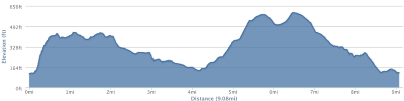
Elevation. Total climb 1145ft. Elapsed time 5:22 h:m.
Moving time 4:03 h:m. Average pace 24:52/mi.
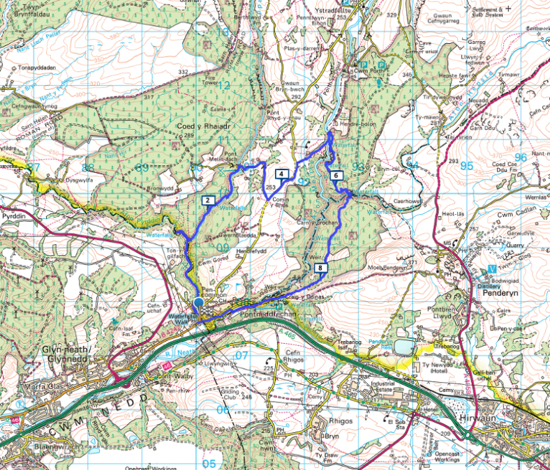
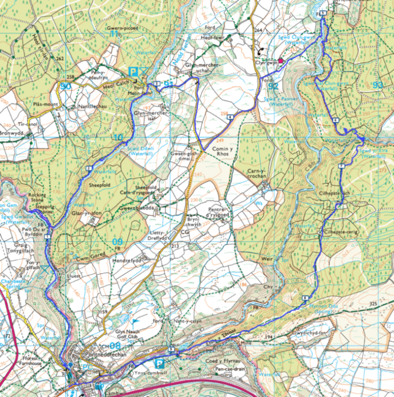
Nestled into the southern slopes of the Fforest Fawr massif, west of Merthyr Tydfil, Waterfall Country is one of the most beautiful and popular parts of the Brecon Beacons National Park and the Fforest Fawr Geopark, with steep, tree-lined gorges and an abundance of tumbling water. Known in Welsh as Coed-y-Rhaeadr (Wood of the Water), Waterfall Country lies within the triangle formed by the villages of Hirwaun, Ystradfellte, and Pontneddfechan. Old red sandstone and a long belt of outcrop limestone have created a highly distinctive environment of wooded gorges, caves, swallow holes and waterfalls. The Rivers Mellte, Hepste, Pyrddin and Nedd-Fechan, tributaries of the Afon Nedd (River Neath), their headwaters in the Fans, wind their way south through Waterfall Country via steep-sided, tree-lined gorges. The most famous waterfall is Sgwd-y-Eira, the Snow Waterfall, on the River Hepste, where a natural path leads right behind the curtain of water.
Date: Wednesday 9 December 2015. Weather: Gusty winds, mild, cloudy
Elevation. Total climb 452ft. Elapsed time 4:41. Moving time 3:05. Average pace 22:17 /mi.
Mwmbwls (Mumbles) today refers to a district covering the electoral wards of Oystermouth, Newton, West Cross and Mayals. The headland is possibly named by French sailors, after the shape of the two anthropomorphic islands comprising the headland. Another possible origin is the Celtic word Mamucium, meaning breast-shaped hill. Mwmbwls lighthouse was built during the 1790s and converted to solar powered operation in 1995. The pier was opened in 1898 at the terminus of the Mwmbwls Railway. At that time one of the oldest passenger railways in the world, it closed in 1960.
Date: Saturday 28 November 2015. Weather: Strong winds; showery.
Route elevation. Total climb 930ft. Elapsed time 4:24. Moving time 3:19. Average pace 21:55 mins / mile.
This ramble provides a demanding walk, encircling the village of Meidrim, to the east and north, twice crossing the Afon (River) Dewi Fawr. The diverse route incorporates hills, stiles and tracks, cattle pastures, equine meadows, cropped fields, farmyards, woodlands, streams and springs. The keen-eyed walker can expect to spot red kite and buzzard and glimpses of a small waterfall. In an area settled since prehistoric times, the village’s origins are thought to lie in the Iron Age. In the early centuries of the second millennium, Meidrim was an important religious centre. Later it had strong connections with the non-conformist movement. In the 17th century, Meidrim’s vicar was known for fervent preaching and publishing texts and translations in the Welsh language.
Date: Wednesday, 25 November 2015.
Weather: Squally winds, light rain.
Route elevation. Total climb: 842 ft.
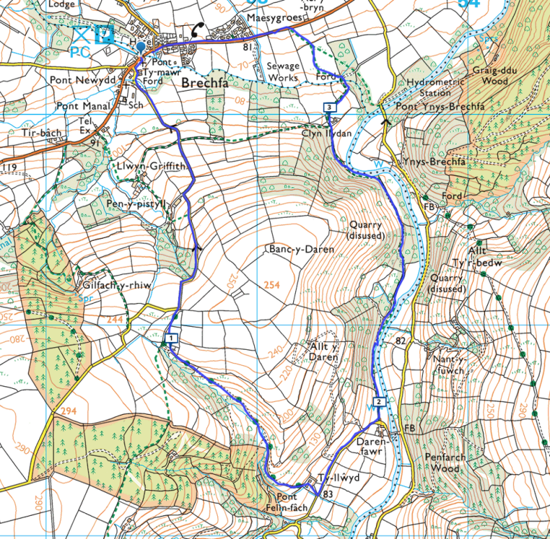
This relatively short ramble is a perennial addition to the Llanelli Ramblers calendar for good reason. It provides a variety of topography and some pleasant views. The walk is essentially a circular route, following the contours of Banc-y-Daren—a hill within the Cwm Cothi (Cothi Valley), overlooking the Carmarthenshire village of Brechfa, which has existed since the 6th century. Brechfa was home to one William Thomas (1834–1879), better known by his bardic name of Gwilym Marles, a Welsh minister, poet and great-uncle to Dylan Thomas. Dylan received his middle name, “Marlais”, in honour of William Thomas, who is believed to have inspired the character of Rev. Eli Jenkins in the play Under Milk Wood.